
Mātai Moana
Eco Sanctuary & Heritage Reserve


Landscape Architecture | Victoria University of Wellington | School Of Architecture
8 x Studies of Mātai Moana
Kia ora
We would like to invite you to the exhibition Ecosanctuary and Heritage Reserve, a new vision for Mātai Moana/Mt. Crawford.
The current phase of the project will be focused on processing the feedback received and facilitating a deliberative process within the community and mana whenua through a series of meetings and workshops.
The final consensus design will represent community aspirations in a cohesive way, combining ideas and solutions from the different designs and the feedback received.
The aim is to present the consensus design at the end of the year.
*if you want to be part of the project and get informed about the coming events towards the final consensus design, please write an email to carles.almoyna@vuw.ac.nz


project feedback
Please provide feedback on the overall project here.
click on QR code to find the survey
if you would like more information or be involved in the future of this project please email carles.almoyna@vuw.ac.nz

The engagement process
towards a consensus design
The ending goal of the project is to develop a consensus design to inform the legal process towards land protection and the gradual transformation of the area. The engagement process has been divided into three stages.
The first stage has been based on the integration of LAND 411/2024 course into the project to collectively produce different designs. Many individuals as well as representatives from mana whenua and more than 20 different community groups have participated in a series of lectures, seminars, workshops and reviews to inform the work developed by the students.
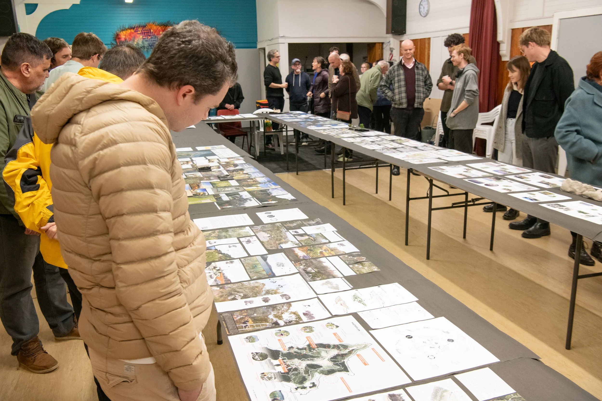
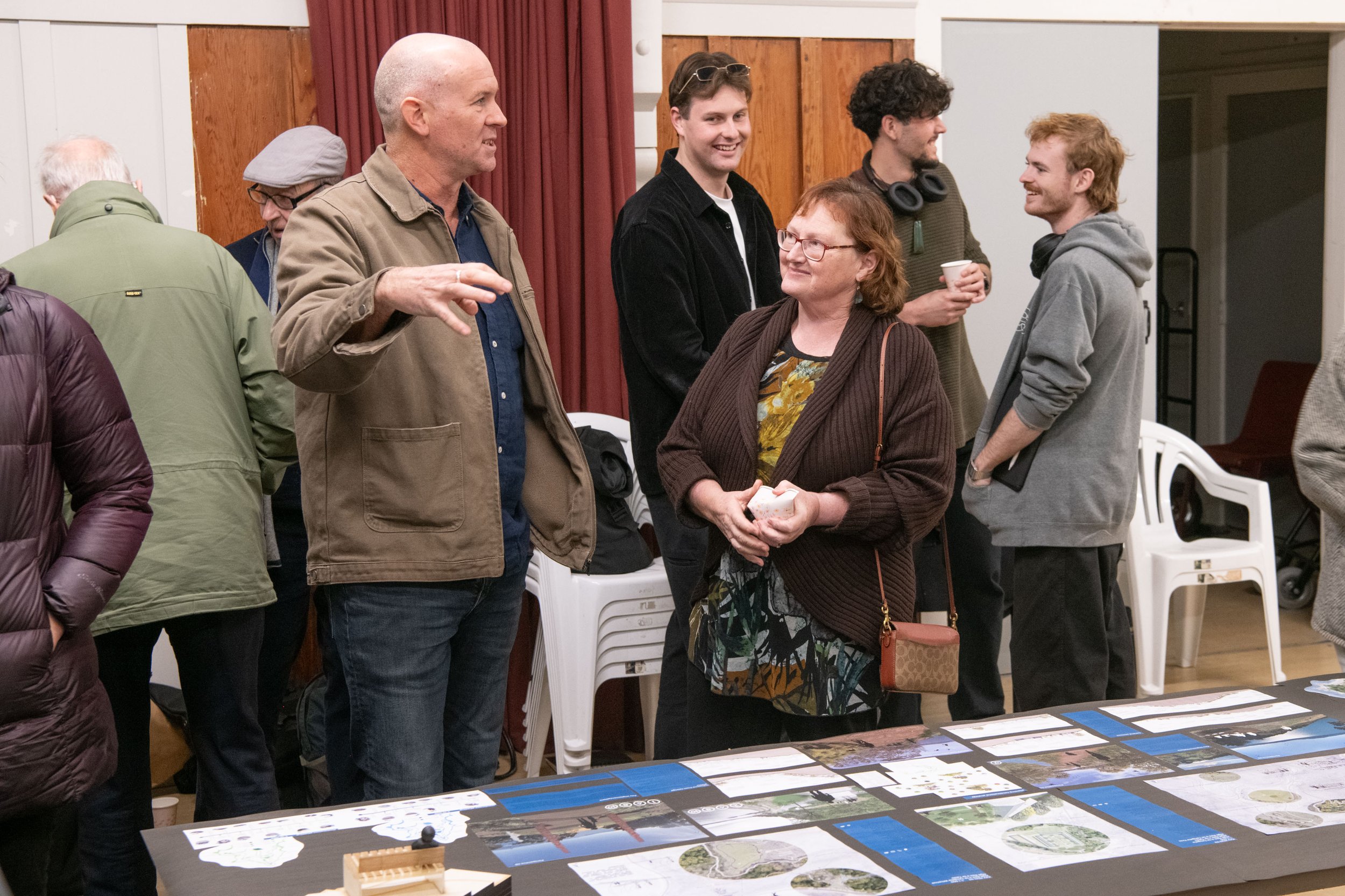
The second phase is being developed through the exhibition. The exhibition has toured through three different venues (Miramar Community Centre, Worser Bay Lifesaving Club and Urban Dream Brokerage) to disseminate the work done, maximize support to the project, and collect feedback to inform the consensus design.
The final phase will be focused on processing the feedback received and facilitating a deliberative process within the community and mana whenua through a series of meetings and workshops. The final design will represent community aspirations in a cohesive way, combining ideas and solutions from the different designs and the feedback received.
The aim is to present the consensus design at the end of the year.
Design objectives
A gradual transformation of the area:
Formulate the design in successive implementation phases and small projects, encompassing the restoration project with natural dynamics, community engagement, institutional support and economic possibilities;
Construction as self-sufficient as possible, considering the involvement of the local community, while maintenance costs should be minimised;
A new coastal edge from Shelly Bay to Scorching Bay:
Change the existing road to one way, and implement slow speed traffic calming solutions;
Restore the coastal habitats, targeting particularly marine avian fauna;
Integrate cycling and walking lanes into the coastal road, facilitating human concentration in key areas for fishing and swimming;
Restoration of terrestrial habitats:
Strategise large scale planting in relation to succession, phasing, rare species and biodiversity to facilitate restoration and management of habitats;
Design against predator reinvasion, with especial attention to the edges of the reserve and public hotspots;
Maximise ecological restoration contemplating accessibility just to public areas and transition zones, leaving inaccessible the most ecologically valuable areas;
Intervening on heritage:
Reveal through design the Māori heritage sites highlighting their significance, contributing to shape culturally related narratives and cultural identity to the reserve;
Restore the military heritage areas and explore the potential reuse of some facilities;
Improve accessibility to the heritage sites through an improvement of the existing path network;
Path network, accessibility and permeability:
Design different entrances to the reserve (with carparks), concentrating main access around the Prison, Shelly Bay and Scorching Bay;
Conceive a diverse framework of pathways that facilitate education and landscape experience;
Protect the highly visible landscape, preserving the open ridgelines for viewing;
Learning and education in the reserve:
Conceive a framework of small interventions to educate the public through sensory and experiential learning;
Integrate ecological restoration, history, cultural heritage, as well as memories and legends as part of the educational experience;
Design some key educational site/s to accommodate exhibitions, events and workshops;
The old Mt. Crawford prison:
Conceive the prison as an important social hub of the reserve, considering the opportunity of improving Wellington’s Art and History facilities;
Keep the three most valuable buildings that draw a U shape in plan;
Shelly bay:
Restore the area as one of the main entrances to the reserve and an important social hub;
Integrate recreational uses, as well as creative and hospitality uses;
Maximise the use of the old dock area and improve the swimming areas;
The farm and the prison gardens:
Preserve and expand both facilities to be transformed as educational sites, accommodate events, or provide services for the reserve as a nursery, storage area, or administrative facilities.
An exceptional land to be protected and revealed
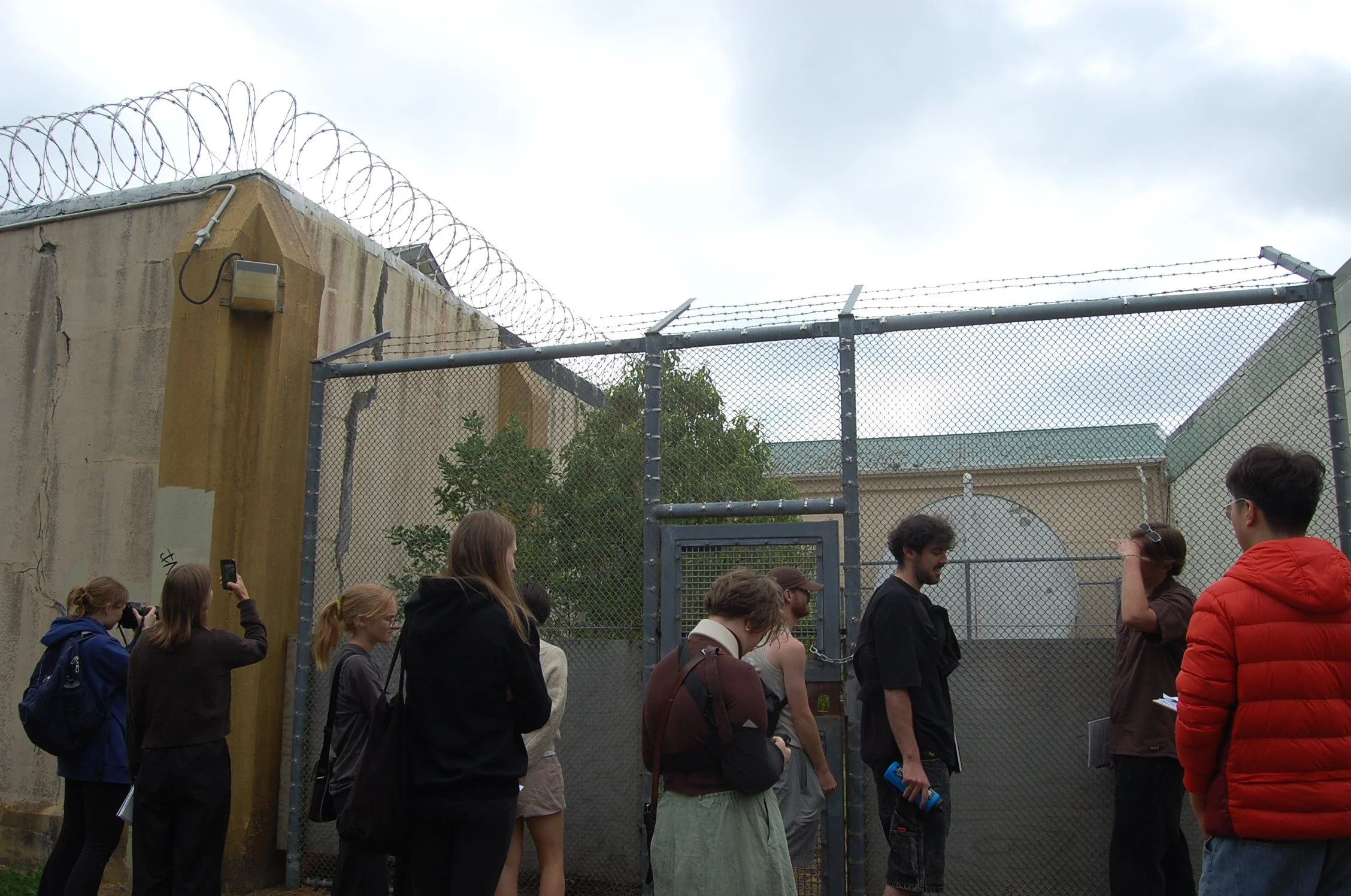
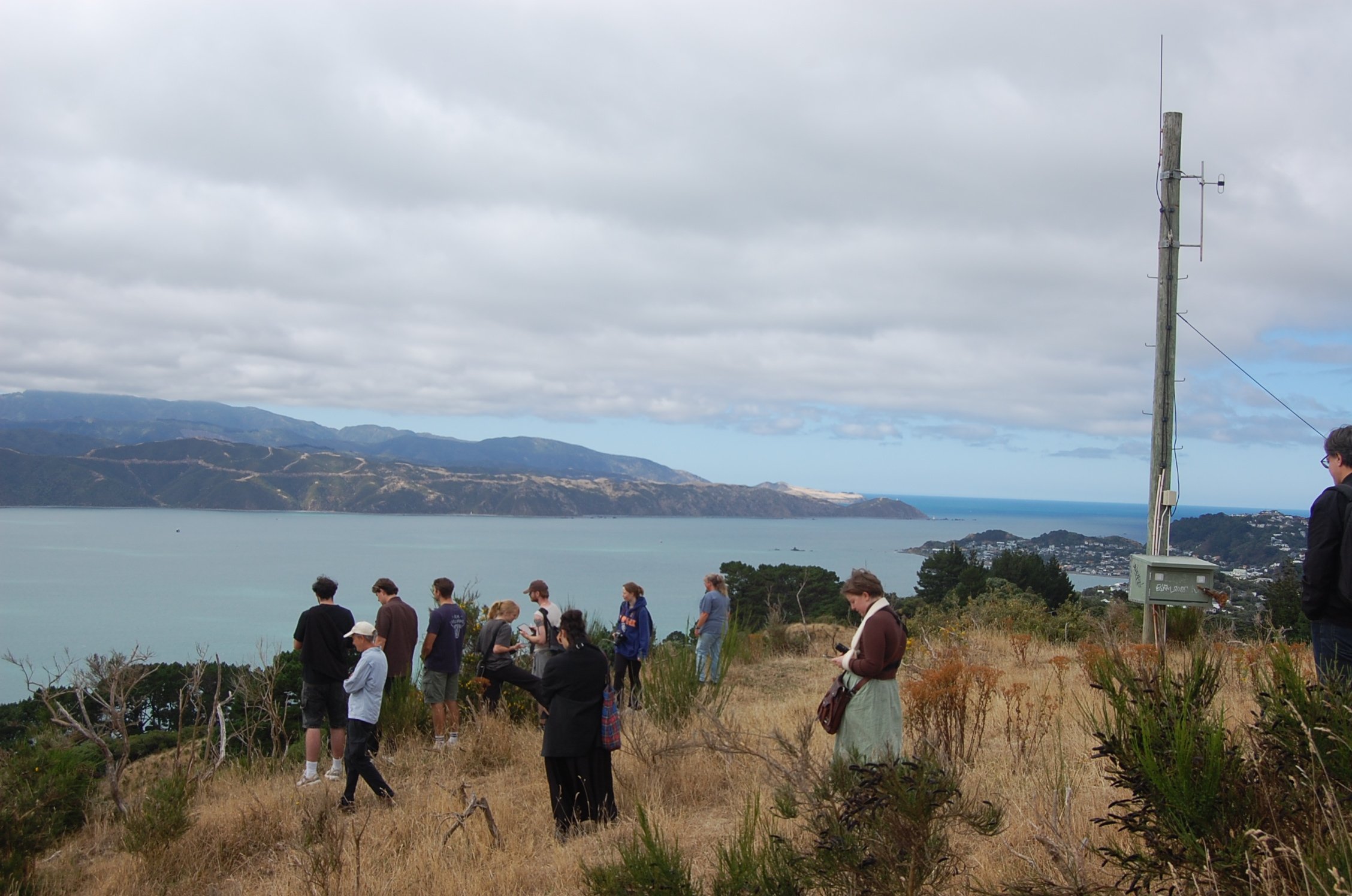
Situated at the northern tip of Te Motu Kairangi (Miramar peninsula), Mātai Moana (Mt. Crawford) is an undeveloped piece of land with an immense historic value, as it holds Māori significant sites, military emplacements, the old Mt. Crawford prison or the Massey memorial. Due to its location in Wellington harbour, the area also holds a strategic ecological value. For the last few years, several local community groups have pioneered the stewardship of the area, developing predator suppression, revegetation works or food production initiatives. Except for the Shelly Bay area, Mātai Moana is public land without a specific legal protection and defined use. Considering its strategic location within Wellington harbour, and its cultural, ecological, and social value, Mātai Moana presents an exceptional opportunity for Wellington City.
An inclusive landscape-based vision for Mātai Moana
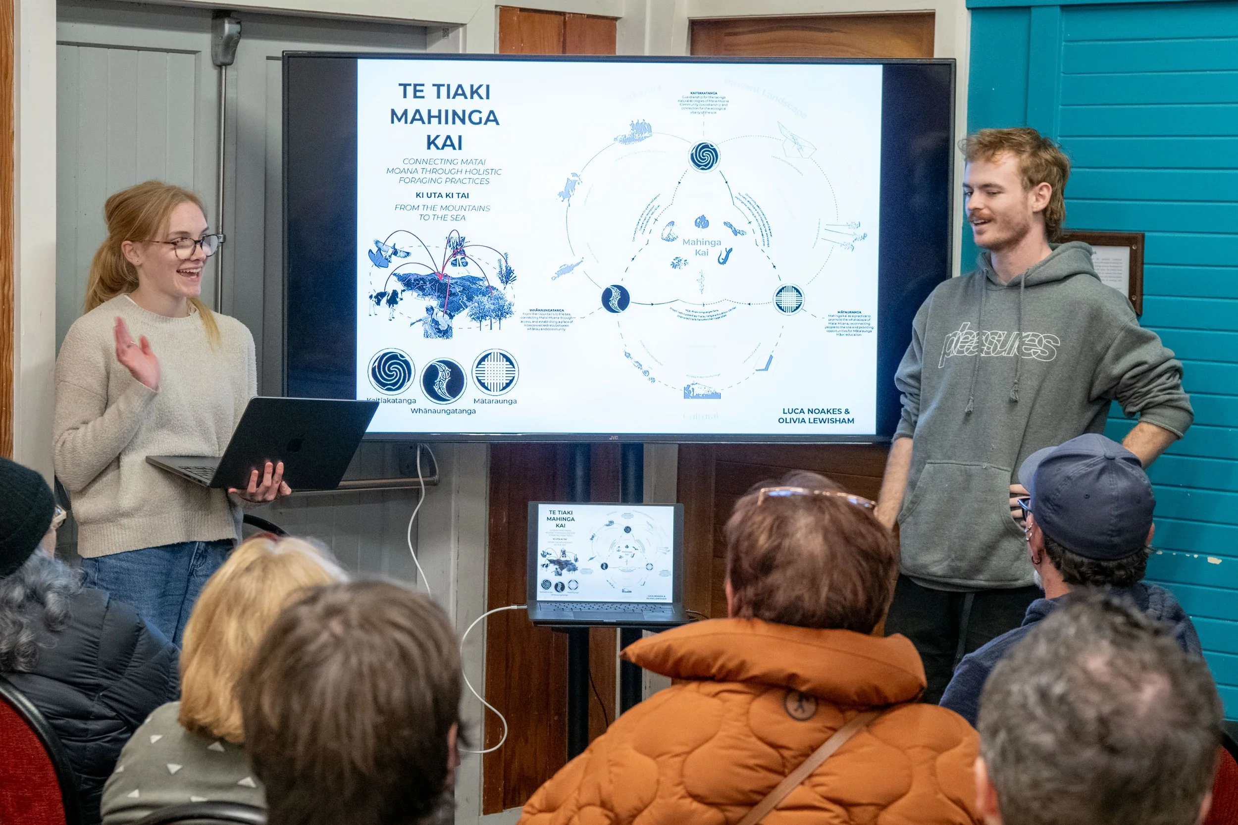
The landscape architecture programme of Te Herenga Waka / Victoria University of Wellington has been working on a participatory design project at Mātai Moana that proposes the transformation of the area into a new Ecosanctuary and Heritage Reserve. The idea of the project has been to use the expertise of VUW/LAND 411/2024 students and staff to run a participatory project with the local community, where different voices with different interests and backgrounds have been heard and considered. Many individuals as well as representatives from mana whenua and more than 20 different community groups have participated in a series of lectures, seminars, workshops and reviews. The goal has been to collectively design different Master Plans for the whole area, as well as a wide range of site-specific interventions to gradually transform Mātai Moana.
Aims of the project
Develop landscape designs grounded on site knowledge, Mātauranga Māori and community aspirations.
Conceive an unfenced ecosanctuary, integrating community efforts as part of a 30 years restoration project;
Integrate in the reserve physically existing heritage, but also removed heritage, intangible heritage, and memories;
Create a public identity and sense of belonging through engagement with biodiversity and cultural heritage;
Facilitate inclusiveness, participation and collaboration during the design process through a series of meetings, seminars, workshops and events;
The participatory design process
The engagement process developed through design has followed these stages.
Diagnosis
Collective analysis:
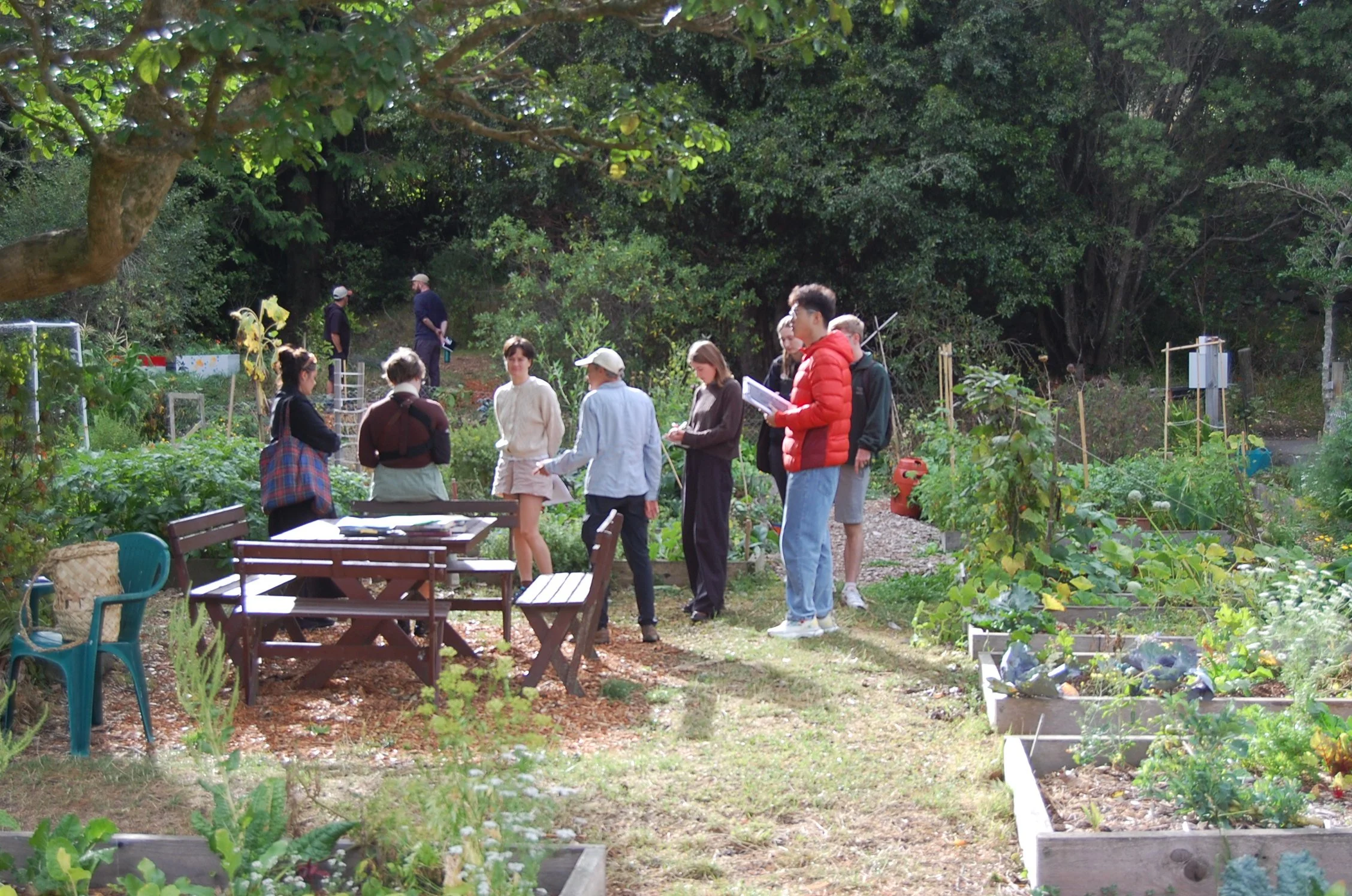
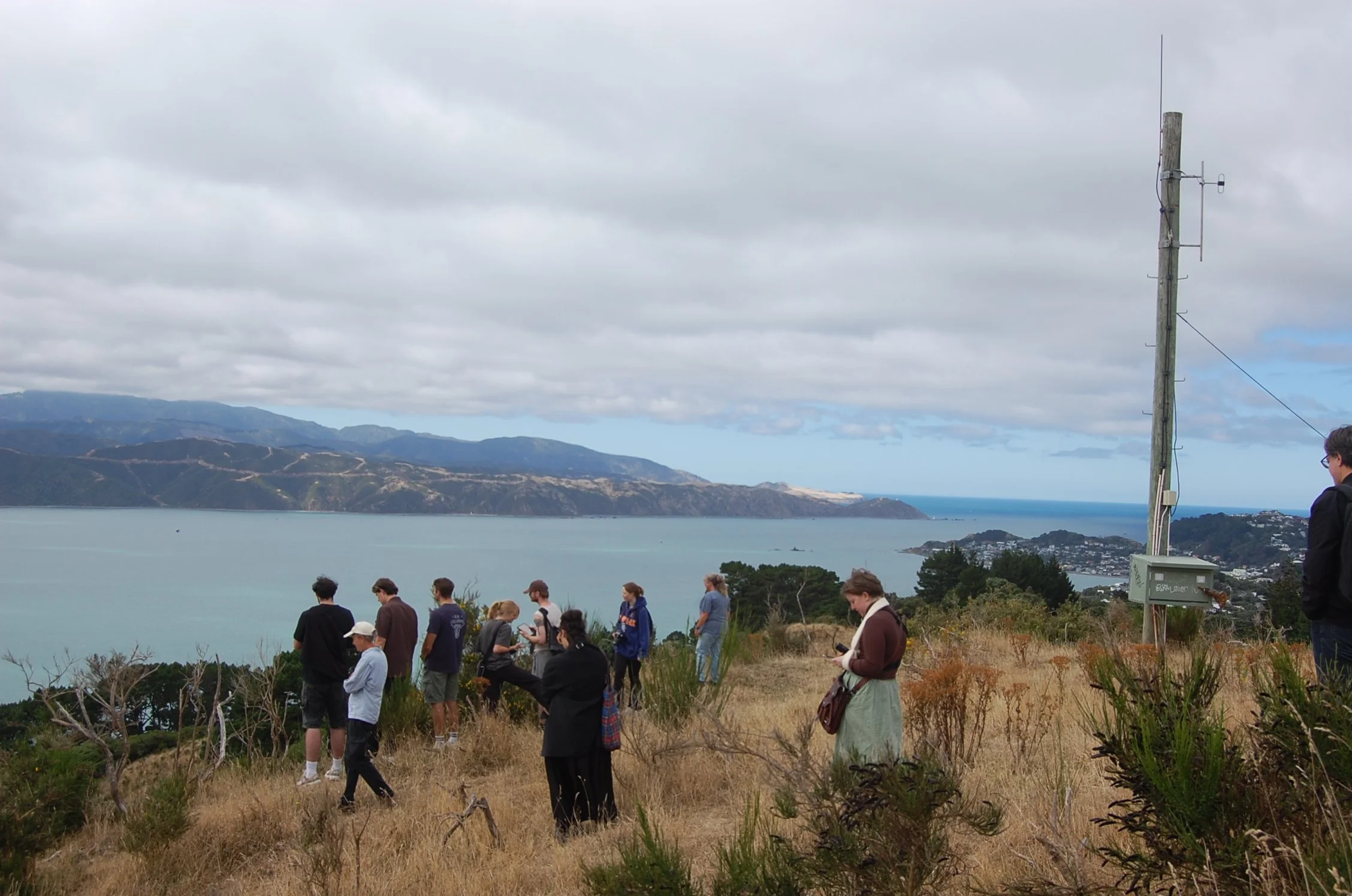
A series of initial site visits were organised with local stewards. Students developed collective research (individually or in groups) around a specific topic previously assigned to each student. Information was collected, processed, drawn and shared with the whole class as part of thematic seminars.
Intentioned analysis and initial design strategies:
A series of thematic lectures and seminars with local experts were organized. Students started the design process, processing and combining the information collectively gathered and shared. A strong attention to collecting relevant inspirational precedents was given during this stage. The ending goal was to produce an intentioned site analysis and conceive some initial design strategies. Final reviews with representatives of different community groups and mana whenua were organized.
Dreaming:
Participatory design workshops:
Three design workshops were organized and though to be informal and inclusive. Many individuals as well as representatives from mana whenua and more than twenty community groups participated. Each workshop was thematic (related to environmental, cultural and social aspects), with a Māori value underpinning and guiding the design-based discussions. These were:
Workshop #1, Kaitiakitanga: managing and conserving the environment as part of a reciprocal relationship. Topics such as habitat restoration methods, environmental stewardship, predator management, or climate change informed the discussions between participants.
Workshop #2, Wairuatanga: the immutable spiritual connection between people and their environments. Topics such as layers of history, memories of repression and trauma, heritage trails or cultural inclusiveness informed the discussions between participants.
Workshop #3, Whanaungatanga: connectedness through shared experiences and working together, which provides a sense of belonging. Topics such as public identity, educational sites, sensory and experiential learning or public art informed the discussions between participants.
Concept design:
In parallel to the workshops, a series of thematic lectures and seminars with local experts were organized. Considering the inputs received, students produced a series of designs for the whole area, as well as key areas. Final reviews with representatives of different community groups and mana whenua were organized.
Defining
Developed design:
The work done during the conceptual phase was continued to produce a developed design considering site knowledge, Mātauranga Māori and community aspirations. The final designs were developed at a wide range of scales and conceived as a cohesive aggregate of small projects to be gradually implemented over time.
A deliberative process towards land restoration:
The engagement process will continue:.
The exhibition:
The exhibition will tour through three different venues during June and July 2024 to facilitate dissemination and maximise impact and support for the project. Two venues based in Miramar peninsula (Miramar Community Centre and Worser Bay Lifesaving Club), and a third one in Te Aro (Urban Dream Brokerage). Visitors will be able to provide feedback on the different designs using analogue and digital mediums. The public will be able to see the designs online and provide feedback through the website:
https://www.toi.agency/vuw-soa.
Post-exhibition:
This final stage will be developed during the second half of 2024. This final phase will be used to process the feedback received during the exhibition and facilitate a deliberative process within the community and mana whenua. The aim will be to develop a final consensus design from the designs produced. This consensus designs will be used to inform the legal process towards land protection and the gradual transformation of the area.
A series of meetings and workshops will be arranged to facilitate the deliberative process.
This will be combined with online tools to facilitate further engagement and participation through https://www.toi.agency/vuw-soa.
If you are new to the project and want to be part of this participatory process in the future, please send an email to Carles.Almoyna@vuw.ac.nz.


© 2024 Victoria University School of Architecture. All rights reserved. The intellectual property rights and ownership of all projects, presentations, and works created by students of the Victoria University School of Architecture, as showcased on this website, are retained by the individual student creators. No part of these works may be reproduced, distributed, or transmitted in any form or by any means, including photocopying, recording, or other electronic or mechanical methods, without the prior written permission of the respective student author.
**Disclaimer**
The views, opinions, and statements expressed in the projects and presentations featured on this website are those of the individual student authors and do not necessarily reflect the official policy or position of the Victoria University School of Architecture or its faculty. The University is not responsible for the content of the student works and assumes no liability for any errors or omissions in the information provided. All student works are provided "as is" without any guarantees or warranty.